Lower Tenn-Tom =
Black Warrior-Tombigbee
Technically the
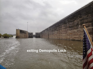
Tenn-Tom Waterway ends at mile 217 when the Black Warrior River joins the
waterway. We reached this juncture early in the morning after leaving the
Rattlesnake bend anchorage – well not so early since we again had a foggy
morning. Providentially the lock gods granted us a short delay since an upriver
bound tow was already in the lock as we approached and our wait was
minimal. We overhead the lock keeper
tell the tow captain that we were headed
his way, and were reassured when the gravelly voiced captain said he would try
not to ram us. Then the captain added he preferred to see the “yachts” rather
than have them appear by surprise as he was coming around a bend. Did we mention that this lower stretch of the
river is mighty twisty? There are famous oxbows which were not straightened and
meeting a tow unexpectedly is not a pleasant surprise for us either.
We use the
AIS feature on our chart plotter regularly to check traffic ahead. It also
gives us the vessel name and speed which helps us anticipate when and where we
will meet – not ram – them. Since we aren’t broadcasting the AIS signal, they
can’t see us, but we can see them. It is
our responsibility to let them know we are here and heading at them. They then tell us which side we will pass on
– the one whistle or two. “See ya on the
two” means we will pass starboard to starboard.
These big guys often need most of the channel on curves and it is our
job to stay out of their way on whichever side they choose. Thankfully traffic
has been light and the occasional chats are not a burden but offer a little
boredom relief.
Another issue we have
encountered these last couple days involves obstacles. From Tarpon Springs, FL
around the keys, we dodged crab pots. On
the ICW north we dodged sand bars and
shallow water. On the Erie we had to
avoid a little debris from the flooding, but the great lakes were mercifully
free of obstacles that float or hide under the water. We have travelled nearly 1500 miles on the
inland rivers and seen few prop destroying obstacles. However, since we left Columbus, the river
has been littered with weeds and in them are hidden logs of various sizes. These mostly bounce off our hull, nonetheless
we try to avoid direct hits least what we can see is the proverbial tip of the
iceberg/log – so to speak. These “obstacles” and the numerous curves are
keeping us alert on our southerly journey.
P.S. An update on the missing
watch – I opted for a replacement rather than a new battery in my old, old one
since I found the perfect boat watch in Dirt Cheap for under $10 – just what
the boat needed! I also upgraded my
anchor duty gear when Paul took us to Tractor Supply in Columbus – my new
“ladies” wellies are keeping my toes dry on these colder mornings when I wash
that anchor and chain. (Even 40 degrees is too cold to do this barefooted!) We
have been fortunate with the weather in the big picture. Those nasty overnight 20s were survived while
snug at Paul and Amanda’s. We have
enjoyed more moderate overnights in the 40s and 50s with daytimes in the 70s or
approaching them. As we continue on
south it looks like the favorable weather and light winds will continue –
hopefully on into St Andrews Marina. So, the fog and light rain are not an
issue – all things considered.


It sounds like your travels are still going good, and that you had fun at the kids! We're in Fort Myers right now, enjoying the warm weather! We received your card. Travel safe! Love, Jeanette& Alan
ReplyDelete